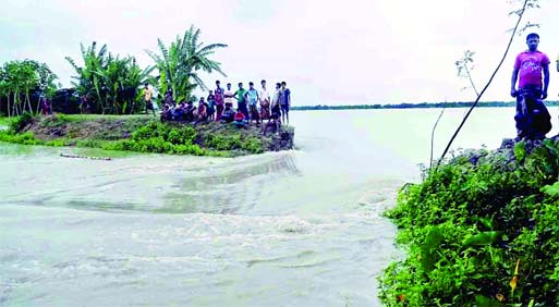

Staff Reporter :’Hudhud’, a very severe tropical cyclonic storm, is likely to cross the North Andhra and South Odisha coast of India by today (Sunday) forenoon, as the cyclonic storm is steadily heading towards the eastern coast of India carrying wind speeds of up to 170 kmph. The officials of Bangladesh Metrological Department (BMD) on Saturday said that the ‘Hudhud’ over the West Central Bay and adjoining East Central Bay moved slightly westwards and was lying over the West Central Bay and adjoining area. The cyclone will cross at noon about 1110 kms southwest of Chittagong port, 960 kms south-southwest of Cox’s Bazar port, 870 kms southwest of Mongla port and 875 kms southwest of Payra port.According to the reports by agencies, the cyclone will first make landfall near Visakhapatnam of India today noon and then in Gopalpur. Lakhs of people were being evacuated from the two towns and villages, as the cyclone will pass amid massive rain and wind. The cyclone is similar to last year’s ‘Phailin’ that crossed the Odisha coast leaving behind a trail of destruction.The authorities of the neighboring country on Saturday took stock of the preparedness of various states and central government agencies in this regard. They took stock of the relief and rescue measures put in place in both the states after discussing the subject with the Chief Secretaries of the Andhra Pradesh and Odisha, reports PTI.Hudhud, formally known as Cyclone 3B, currently at the equivalent of a Category 2 hurricane with winds sustained at 195 kph (121 mph), will likely become stronger prior to making landfall in eastern India this weekend.According to a special bulletin of the BMD, maximum sustained wind speed within 74 kms of the storm centre is about 130 kph rising to 150 kph in gusts/squalls. Sea will remain very high near the storm centre.Under the peripheral influence of the severe cyclonic storm, deep convection is taking place over the North Bay. Gusty/squally wind may continue over the North Bay, coastal areas and the maritime ports of Bangladesh.The maritime ports of Chittagong, Cox’s Bazar, Mongla and Payra have been advised to keep hoisted local cautionary signal No 3.In this situation, the low-lying areas of the coastal districts of Cox’s Bazar, Chittagong, Noakhali, Laxmipur, Feni, Chandpur, Barguna, Bhola, Patuakhali, Barisal, Pirojpur, Jhalakati, Bagerhat, Khulna, Satkhira and their offshore islands and chars are likely to be inundated by wind-driven surge of 1-3 feet height above normal astronomical tide.All fishing boats and trawlers over the North Bay have been advised to remain in shelter till further notice.Meanwhile, movement of ferry and public life disrupted in several parts of the country due to unfavorable weather which was created due to the influence of the very severe cyclonic storm. Bangladesh Inland Water Transport Authority (BIWTA) stopped the movement of launch in Mawa-Kawrakandi route. Official of the Mawa port of the BIWTA Mahiuddin Ahmed said that they stopped the movement of the launch to as high surge was continuing in the Padma River. On the other hand, a number of tourists have been trapped in Coxbazar, as the tidal water in Bay of Bengal was increased by four feet due to the Hudhud. The tourists were trapped in Saint Martin Island, as they can’t back from there due to stopping of the movement of ship. No ship went to the Island on Saturday due to the unfavorable weather, So, above 300 tourists were trapped in the island. The sea remained high. When the weather will be normal, the trapped tourists can move from the Island, said Shah Mujahid Uddin, UNO of Teknaf.
