
(CNN) :
Hurricane Michael is poised to slam Florida’s Panhandle by Wednesday afternoon, threatening dangerous storm surges to low-lying areas ill-equipped to handle them-and officials are urging people to get out of the way now.
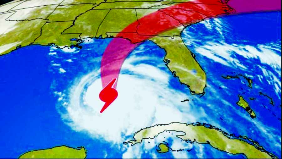
Michael, spinning in the Gulf of Mexico as a Category 2 storm Tuesday morning, is expected to strengthen even more before making landfall Wednesday, possibly as a Category 3.
Tropical-storm-force winds will be felt in the area starting early Wednesday, and evacuations already are being ordered in at least 10 Florida counties in and near Florida’s Panhandle and Big Bend coasts.
“No more prep work tomorrow morning-it needs to be done today,” CNN meteorologist Chad Myers said Tuesday.
Michael’s core, with maximum sustained winds of 100 mph, was about 395 miles south of Panama City, Florida, as of 8 a.m. ET Tuesday, the National Hurricane Center said. Hurricane-force winds extended outward up to 40 miles from the center and tropical-storm-force winds outward up to 195 miles.
The storm’s center and where it makes landfall with its destructive winds represent just one of several concerns. Among them:
Storm surges of 9 to 12 feet could slam the coast from roughly Apalachicola to Cedar Key, Florida, with only slightly lower surges farther to the west along the Panhandle coast.
Heavy rain and flooding are expected not just for Florida but also for other parts of the Southeast. Up to 12 inches of rain could fall in Florida’s Panhandle and Big Bend areas, southeastern Alabama and southern Georgia, while parts of the Carolinas and southern Virginia eventually could see up to 6 inches, the hurricane center said.
