Pooja Pillai :
Last week, on the road from Shillong to Guwahati, our voluble driver touched on many topics: the best way to eat the massive pomelos we saw all over Meghalaya, the lack of employment opportunities for the region’s youth, the detoxifying power of the Bhut Jolokia chilli pepper and the drying up of Cherrapunji’s rains.
“Many years ago, no matter what time of the year you went to Cherrapunji, it would be raining. Now it’s become dry,” he says. We had been in the same area earlier that day, climbing up from the Nongriat village – famous for its breathtaking double-decker living roots bridge – and the signs of its famed rains, literal signs too, had been everywhere. All across Sohra – the Khasi name for Cherrapunji – visitors are exhorted to enjoy ‘romance in the rains’ in ‘the wettest place on earth.’ But, a close observer would be able to guess how the Cherrapunji of today is gradually becoming less and less like the Cherrapunji of the record books, which once received 1,500 mm of rain in a single day.
Not that it isn’t still very wet. On an average, the town continues to receive well over 11,000 mm of rainfall a year. The reason why Cherrapunji, and the nearby village of Mawsynram – believed to be the current wettest place on earth – are so rainy is because of the alignment of the Khasi Hills in the specific region where the two villages are located. Rain-heavy clouds brought in by the southwest and northeast monsoon winds collide with the hillside and are forced upwards. As they reach higher elevations, they cool down and drench the slopes, with the plateau on which Cherrapunji is located, consequently receiving the most rain. In fact, driving from Shillong to Cherrapunji or Mawsynram, it is quite common to be completely enveloped by the passing clouds. Visitors get an instant understanding of why no name but ‘Meghalaya’ would have suited this hill state when it was carved out of Assam in 1972.
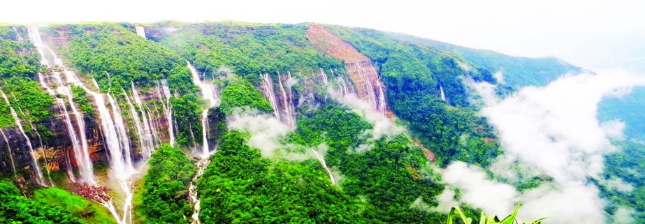
Conversations with locals reveal that water shortage is common in the town. The plateau is unable to retain the water that pours down so generously, thanks to decades of deforestation and development. Instead, the rainwater runs downhill, gurgling down as mountain streams or cascading as majestic waterfalls at the height of monsoon. The hillsides remain green, although one wonders for how long, since even villages like Nongriat, which receive the run-offs from the plateau, are running low on regular water supply. This could be due to multiple factors – climate change, steep rise in local population and the pressures of tourism and development. The truth is the clear surreal blue of the waterfalls and pools around the Cherrapunji plateau can only do so much to hide the dark realities of climate change.

